How Cartographers For the US Military Inadvertently Created a House of Horrors in South Africa
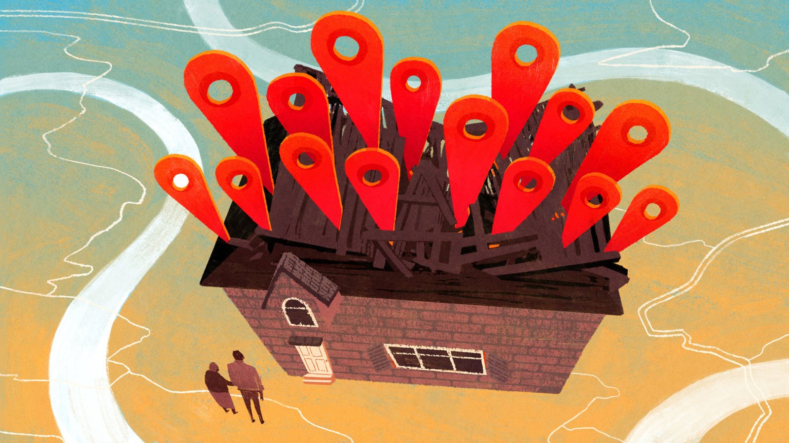
The visitors started coming in 2013. The first one who came and refused to leave until he was let inside was a private investigator named Roderick. He was looking for an abducted girl, and he was convinced she was in the house. John S. and his mother Ann live in the house, which is in Pretoria, the administrative capital of South Africa and next to Johannesburg. They had not abducted anyone, so they called the police and asked for an officer to come over. Roderick and the officer went through the home room by room, looking into cupboards and under beds for the missing girl. Roderick claimed to have used a “professional” tracking device “that could not be wrong,” but the girl wasn’t there. This was not an unusual occurrence. John, 39, and Ann, 73, were accustomed to strangers turning up at their door accusing them of crimes; the visitors would usually pull up maps on their smartphones that pointed at John and Ann’s backyard as a hotbed of criminal activity.
The outline of this story might sound familiar to you if you’ve heard about [other places and similar settings] and it is, in fact, similar: John and Ann, too, are victims of bad digital mapping. There is a crucial difference though: This time it happened on a global scale, and the U.S. government played a key role. Technologist Dhruv Mehrotra crawled MaxMind’s free database for me and plotted the locations that showed up most frequently. Unfortunately, John and Ann’s house must have just missed MaxMind’s cut-off for remediation. Theirs was the 104th most popular location in the database, with over a million IP addresses mapped to it.